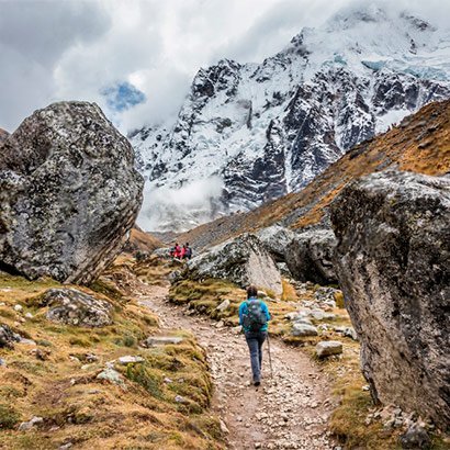
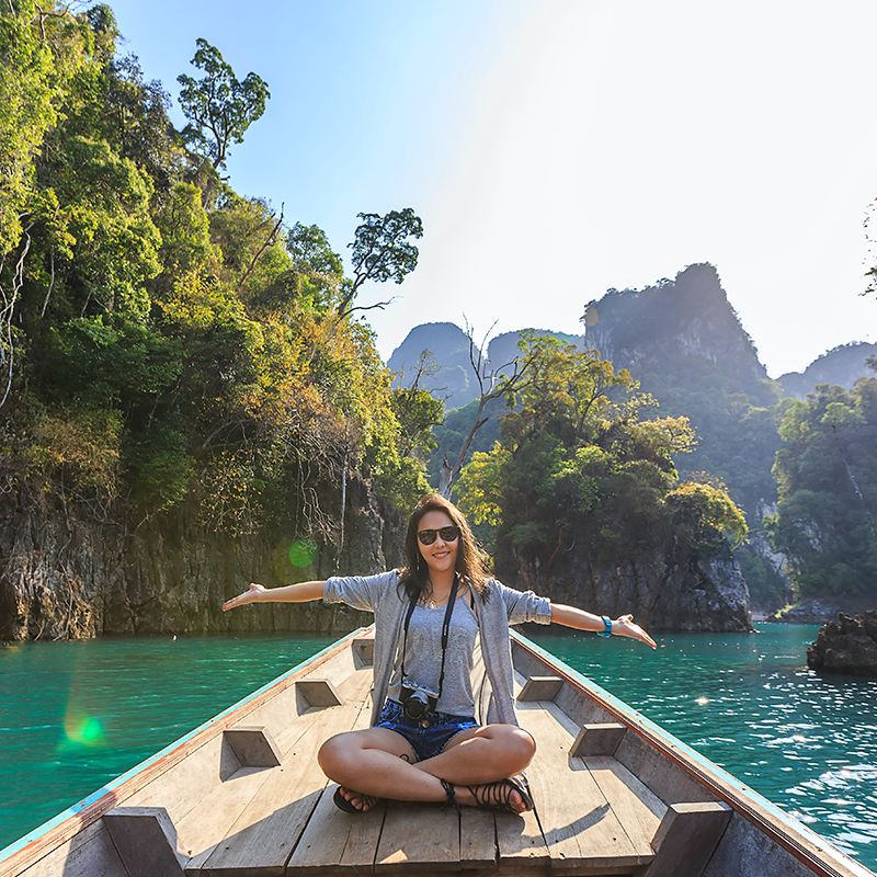
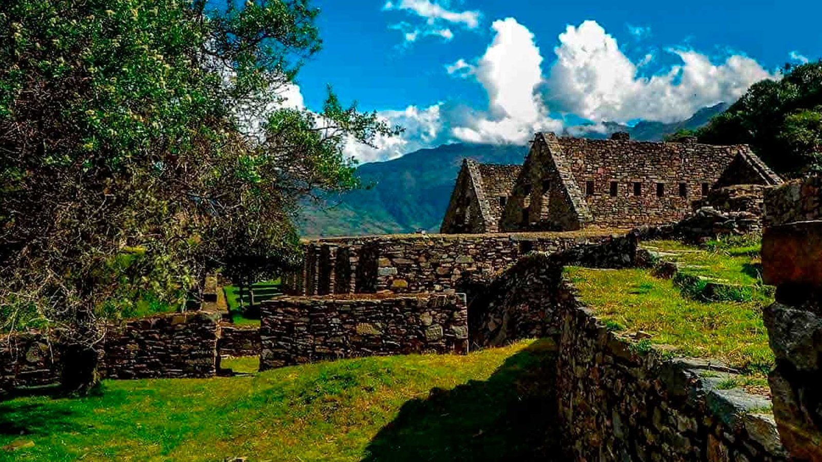
The 9 Day Choquequirao Trek to Machu Picchu is one of the most beautiful and interesting treks on offer in the Cusco region. Following little visited pathways and Inca Trails, beautiful scenery and visits to the two major Inca sites in the area, this trek has it all!
The trek begins following the regular route for Choquequirao but instead of returning the way you came you continue on and eventually joins the last section of the Salkantay trek to arrive to Machu Picchu.
By booking your Choquequirao Trek with Amazon Andes Peru you are choosing the best. Don’t believe us? Check out our reviews on TripAdvisor!
Useful Information
- Starting Altitude – 2900m / 9515ft.
- Highest Altitude – 4840m / 15,879ft.
- Walking Distance – 100km / 62 miles
- Longest Day – Days 1 and 6, approximately 18km / 11.2 miles
- Overall Difficulty – Difficult
- Aclimatization is highly Recommended.
Very Important: Campsites may vary depending on booking time, weather conditions or on restrictions undertaken for safety reasons by the Peruvian Goverment.
Tour Type / Category:
- Adventure & Trekking Tour – Long multi-day trek through the Andes, suitable for active travelers and nature lovers.
- Cultural & Historical Tour – Exploration of Inca archaeological sites, including Choquequirao, Llactapata, and Machu Picchu.
- Nature & Wildlife – Hiking through diverse ecosystems with opportunities to observe Andean flora and fauna.
Location:
- Starting Point: Cusco, Peru
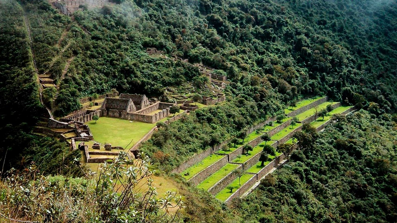
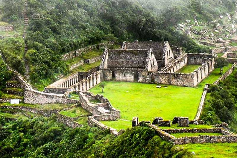
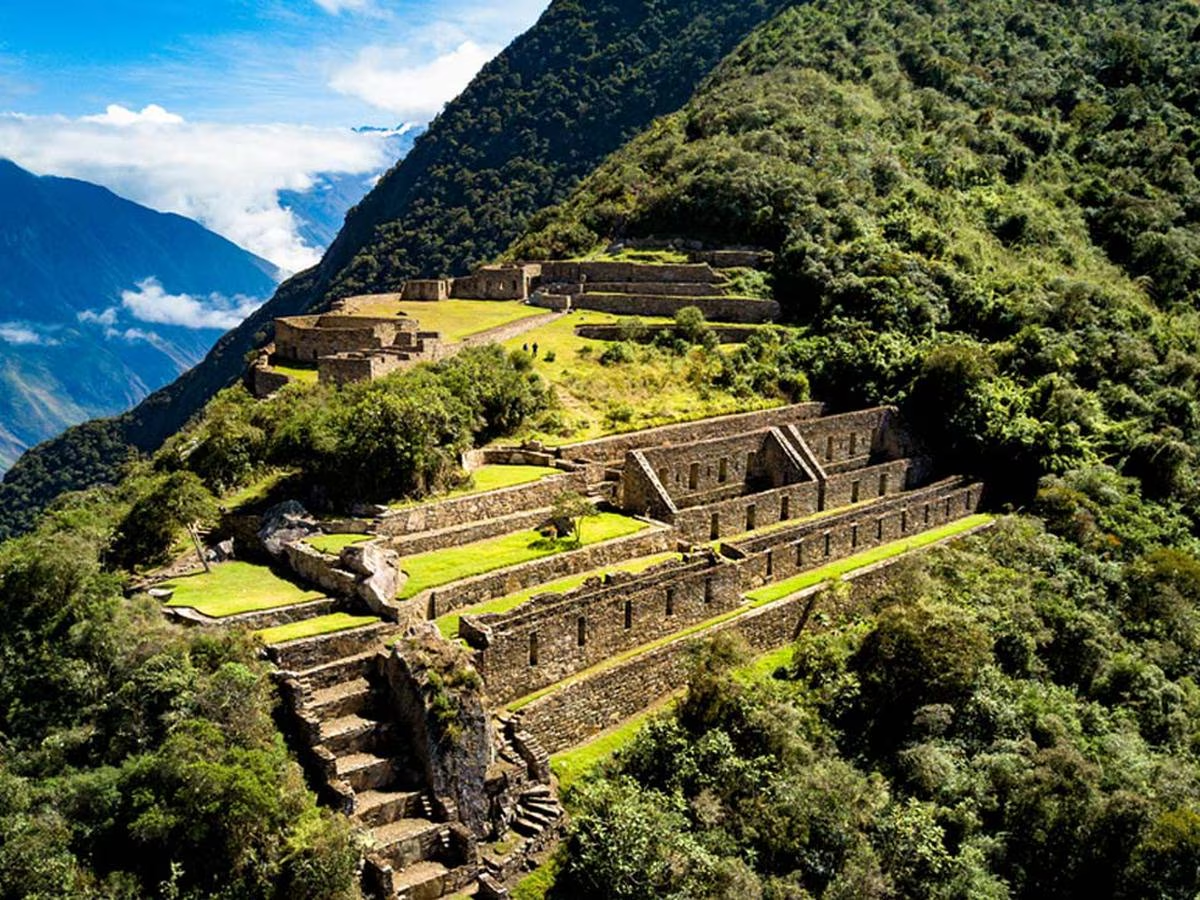
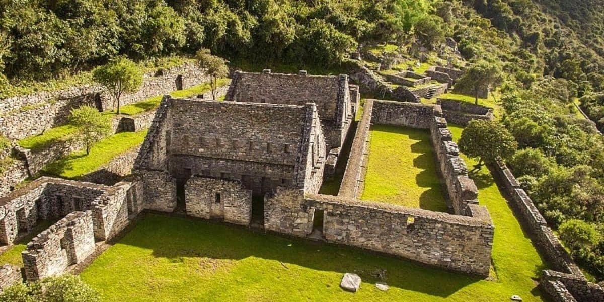
- Main Trek Route: Cachora → Santa Rosa → Choquequirao → Pinchinuyoc → Maizal → Yanama → Colpapampa → La Playa → Llactapata → Aguas Calientes → Machu Picchu
- Regions Covered: Apurímac Valley, Vilcabamba mountain range, Rio Blanco Valley, Sacred Valley, and the Machu Picchu area
Duration:
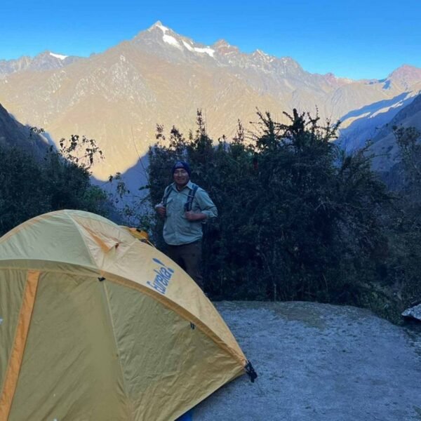
- 9 days / 8 nights
- Trekking Distances: 8–25 km per day (approx. 5–12 hours walking each day)
- Altitude Range: 2,040 m / 6,693 ft – 4,840 m / 15,879 ft
Highlights:
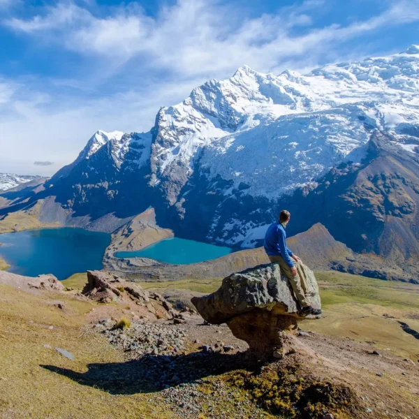
- Visit the remote Inca city of Choquequirao
- Trek through lush valleys, high puna grasslands, and tropical cloud forests
- Observe diverse Andean flora and fauna, including orchids, bromeliads, and birds like Quetzals and hummingbirds
- Explore Llactapata, an Inca site with stunning views of Machu Picchu
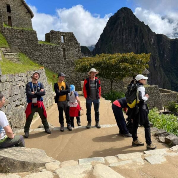
- Enjoy the final visit to the legendary Machu Picchu with an optional climb to Huayna Picchu or Machu Picchu Mountain
Ideal For:
- Adventure seekers and experienced trekkers
- Travelers interested in Inca history and archaeology
- Nature and wildlife enthusiasts
IMPORTANT NOTICE :
- ZERO PLASTIC BOTTLES ON THE INCA TRAIL AND MACHU PICCHU FROM DECEMBER 1ST:
- Due to New goverment regulations for the Inca Trail it will be 100% PROHIBITED to TAKE PLASTIC WATER BOTTLES. We believe that in the first days the new enforced regulations may NOT be 100% controlled however as the days go it will be more and more strict therefore WE KINDLY suggest you getting your aluminum plastic bottles to avoid any dissapointment at the check points along the Inca Trail and in the Machu Picchu citadel.
- ALUMINUM 0.700ml BOTTLES:
- As a way to avoid any inconvenience with our clientes Amazon Andes Peru offers 0.700ml aluminum water bottles FOR SALE at the office for as liitle as 10 Soles (USD3.00).
- Aluminum water bottles can also be bought in many different shops around the main square.
- Also, if you are still at home and ready to fly to Peru for your trek we recommend you bringing aluminum water bottles or camel bags.
We look forward to meeting you.
What you need to take:
- Original Passport
- Student card (if you are a student and want to qualify for the discount)
- Walking boots
- Waterproof jacket / rain poncho
- Warm jacket
- Hat and gloves
- T-shirts
- Comfortable Trousers
- Sun hat
- Sun cream (factor 35 or higher)
- Insect repellant
- Toiletries and hand sanitiser
- Personal medication
- Camera and film
- Torch with spare batteries